In Brief
Before and After
In response, the Copernicus Emergency Rapid Mapping Service has been activated to provide satellite imagery that can support rescue and recovery efforts.
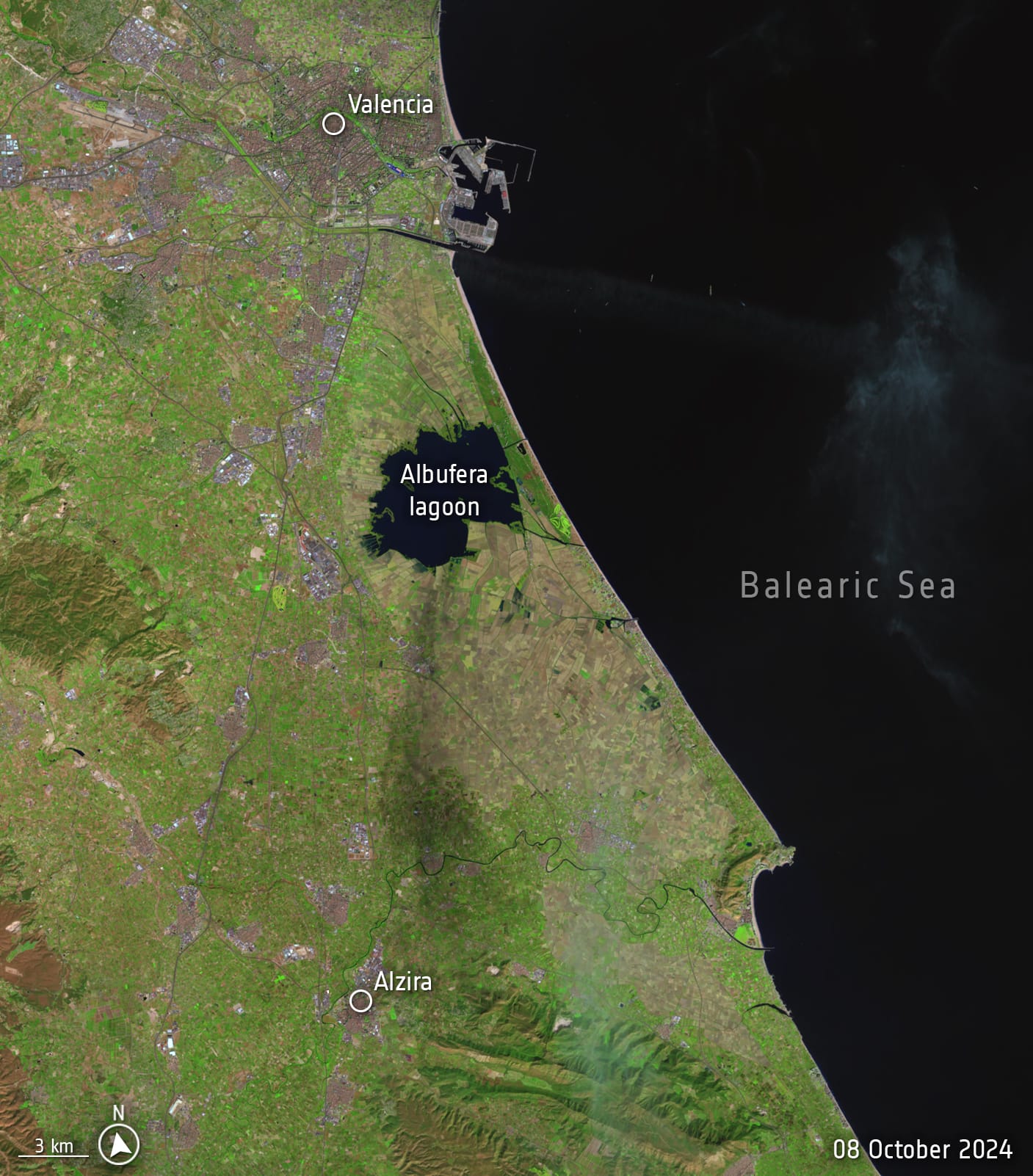
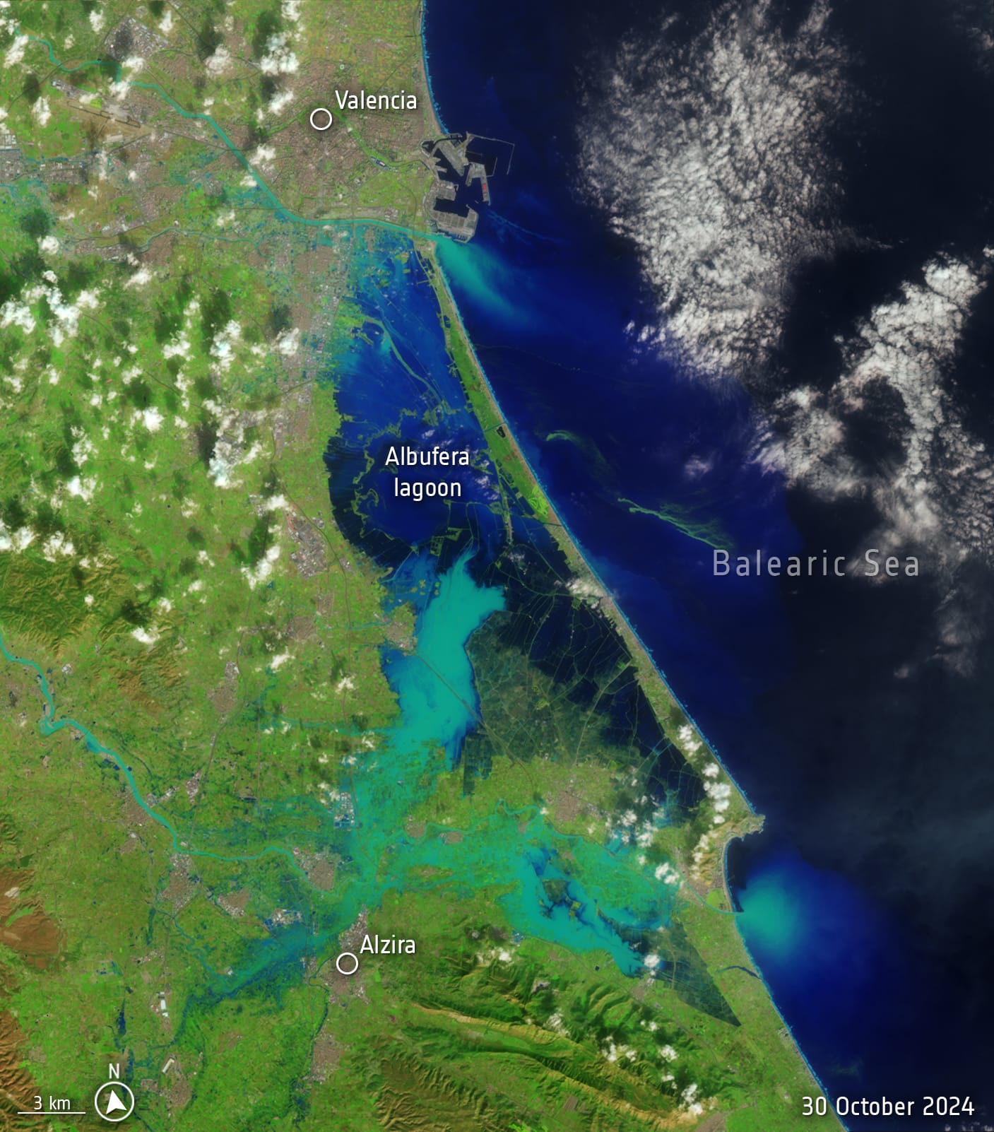
Images from the US Landsat-8 satellite vividly illustrate the scale of the disaster, with images from 8 October and 30 October showing the dramatic transformation of the landscape.


Source: USGS, processed by ESA
Situation Report
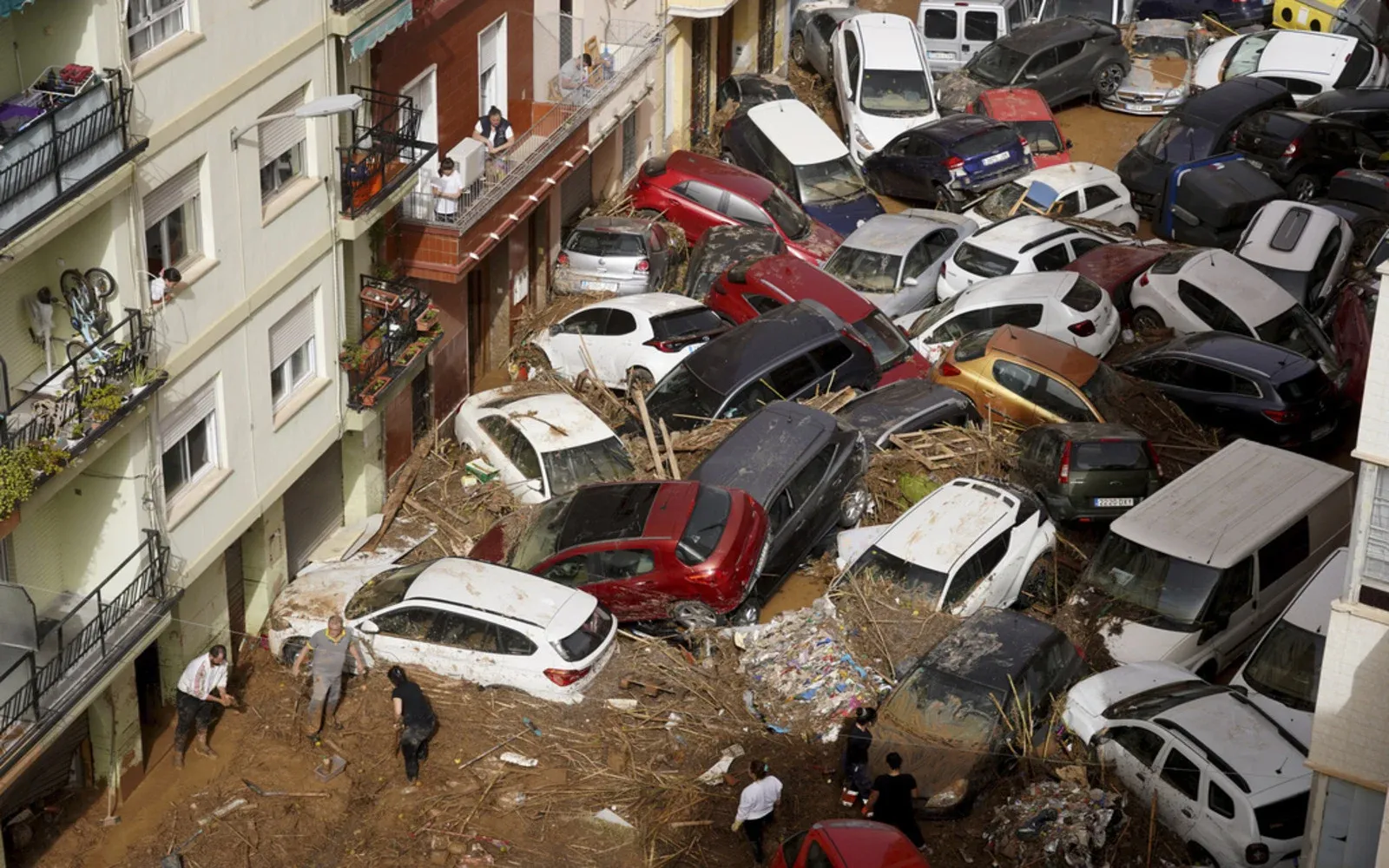
This week, Spain experienced devastating flooding following an unprecedented deluge that dropped a year's worth of rain in just a few hours, particularly affecting east-central regions like Chiva near Valencia. The torrential rains caused rivers to overflow their banks, inundating streets and washing away vehicles and infrastructure.
As of the night of Thursday, October 31st, the death toll had risen to at least 155, with many individuals still unaccounted for as search and rescue operations are underway.
Satellite images taken on October 30 reveal the extent of the flooding, with previously dry land now submerged under water, creating what appears to be an inland sea. The rapid rise in water levels has transformed familiar landscapes, turning coastal areas into isolated islands and highlighting the severity of the disaster.
Meteorological data indicates that the rainfall was approximately 12% heavier than historical averages and twice as likely to occur now compared to pre-industrial times due to climate change influences. In Chiva alone, meteorological reports confirmed that nearly 19 inches of rain fell within an eight-hour window.
The catastrophic flooding in Spain serves as a stark reminder of the increasing frequency and intensity of extreme weather events attributed to climate change. As global temperatures rise due to fossil fuel emissions, regions previously thought resilient are now facing unprecedented challenges from natural disasters.
Policymakers and urban planners must further integrate climate resilience into their frameworks to mitigate future risks associated with similar extreme weather events.


Discussion